>Agricultural Sediment
Home » Research » Projects » Agricultural Sediment

Agricultural Sediment

Process-based Investigation of Sediment Transport and Deposition in Irrigation Dominated Watersheds

Greg_PengGao400.JPGParticipants

Gregory B. Pasternack. Peng Gao, Wesley W. Wallender, and Khaled Bali

Purpose

The purpose of this study was to investigate the physical processes that control sediment movement in agricultural drain channels and to establish the empirical model describing the variation of the sediment load.

Methods

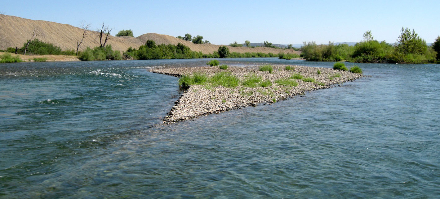
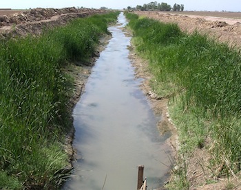
The study area was limited to the Holtville main drain system in the Salton Sea basin in the Imperial Valley of arid Southern California, whose east part was a linear channel network and west part was a dendritic network. An extensive turbidity and stage monitoring program based on grab sampling using 500-mL plastic bottles and in situ monitoring using both turbidity sensors and pressure transducers was designed to represent spatial and temporal heterogeneities of sediment loads. The obtained data included (1) weekly stage and turbidity at 15 sites, (2) 5-minute stage and turbidity at 6 sites, (3) random turbidity and sediment concentration in irrigated fields and drain channels, (4) intermittent stage and discharge at 12 sites, and (5) daily stage and turbidity at one site. The turbidity and stage values were subsequently converted to corresponding sediment concentrations and discharges using various established turbidity-concentration relationships and stage-discharge relationships. At weekly time scale, mass balance approach was taken to distinguish erosion and deposition processes in drain channels at various spatial scales, which were then verified by cross section measurements and analysis of spatial distribution of sediment loads.

agdrain350.JPG

Project Findings

Based on detailed analysis, a model describing the process of sediment transport at various spatial scales was developed. It revealed that drain channels at larger scales tended to be dominated by deposition, while those at smaller scales were inclined to be controlled by erosion at the weekly time scale. Further analysis on sediment dynamics at the 5-minute scale exposed that at small-scale drain channels, deposition occurred in a very short period of one week (about one day) with high rate, though the remaining period was dominated by less intensive erosion. Therefore, regarding both spatial and temporal variations, sediment transport in the Holtville sub-drain system was generally controlled by deposition. This provided a scientific reason for the necessity of channel dredging, which has been regularly conducted by IID.

Investigating the impact of various agricultural practices (i.e. land use, irrigation methods, land cover, and soil texture) and channel morphology change on the process of sediment transport indicated that land use and irrigation methods are two most important factors that affect sediment transport. Any implementation of best management practices needs to concentrate on the variation of these two factors. The significant disturbance of multiple factors other than water discharge on sediment transport prevented any reliable sediment rating curve from being developed for drain channels at small and meso spatial scales. As an alternative, the empirical models for sediment transport at three different time intervals were developed at the large spatial scale. However, the nature of sediment transport -the high variation of sediment load within a narrow range of discharge variation determined that the models failed to provide accurate estimation of sediment load for a given discharge. It is therefore not reliable to use an empirical model in terms of three-month data to evaluate sediment load in the rest of a year. Even so, the results indicated that process-based study is still critical to understanding sediment dynamics at various spatial and temporal scales. The study also suggest that estimating sediment load using data on a monthly base is not accurate at all as the monthly sampling missed many important sediment variations occurred at finer time scales.

Publications

  • Gao, P., Pasternack, G. B., Bali, K. M., Wallender, W. W. 2007. Suspended sediment transport in an intensively cultivated watershed in southeastern California. Catena 69:239-252.
  • Gao, P. and Pasternack, G. B. 2007. Dynamics of suspended sediment transport at field-scale drain channels of irrigation-dominated watersheds in the Sonoran Desert, southeastern California. Hydrological Processes 21:2081-2092.
  • Gao, P., Pasternack, G. B., Bali, K. M., and Wallender, W. W. 2008. Estimating suspended sediment concentration using turbidity in an irrigation-dominated southeastern California watershed. Journal of Irrigation and Drainage Engineering 134:2:250-259.
  • Gao, P., Pasternack, G. B., Bali, K., and Wallender, W. 2005. Impact of agricultural practices on soil erosion at the field-scale in the Salton Sea watershed. In (M. Svendsen, D. Wichelns, S. S. Anderson, Eds) Water District Management and Governance- Third International Conference on Irrigation and Drainage. US Committee on Irrigation and Drainage, Denver, p. 571-580.
  • Bali, K. M., Gao, P., Pasternack, G. B., Wallender, W. W. 2006. Calibration and use of in situ turbidity sensors for estimating sediment load in drainage waters. In (C. M. Burt and S. S. Anderson, Eds) SCADA and related technologies for irrigation district modernization- Third International Conference on Irrigation and Drainage. US Committee on Irrigation and Drainage, Denver, p. 257-270.
>Agricultural Sediment
  • Home
  • About Me
  • Research
    • Scientific Highlights
    • Projects
      • Near-Census River Science
        • 2DMUs
        • Hydraulic Topography
        • Topographic Change Detection
        • Topographic Change Processes
        • Floodplain Inundation
        • Streamwood Storage
        • Upper South Yuba
        • Salmonid Migration
        • North Yuba River
        • Salmon Migratory Habitat
      • Geomorphic Covariance Structures
      • Synthetic River Valleys
      • Watershed Processes
        • Watershed Sediment Transport
        • Watershed Streamwood
        • Watershed Sedimentation
      • River Rehabilitation
        • Spawning Habitat Rehabilitation
        • Cobble/Gravel Injection
        • Streamwood Jams
        • Geomorphologist's Guide
      • Waterfalls
        • Horseshoe Falls
        • NSEAM 1.0
        • Hydraulic Jumps
        • Small Step Mapping
        • Small Step Hydraulics
      • Tidal Freshwater Deltas
        • TFD Introduction
        • TFD Vegetation
        • TFD Sediment Cycles
        • TFD Ecogeomorphology
        • TFD Hydrometeorology
        • TFD Sediment Transport
        • TFD Modeling
        • TFD Animal Response
        • Bush River, MD
        • Winter's Run, MD
      • Estuarine Processes
        • Salinas River Estuary
        • San Joaquin-Sacramento Delta
        • Blackwater National Wildlife Refuge
        • Long Island Sound
      • Functional Flows Model
      • Volcanic Lakes
        • VL Classification & Modeling
        • VL Bibliography
        • Keli Mutu
          • Remote Sampling Strategy
        • Lake Batur
        • Other Volcanic Lakes
      • Agricultural Sediment
      • Urban Rivers
      • Chaos in Hydrology
      • Channel Types
    • Methods
      • Net Sedimentation Tile (NST) Protocol
      • Sediment Core Processing Protocol
      • Vibracoring Protocol
      • Loss-On-Ignition Protocol
      • C-14 Sample Selection and Prep Protocol
      • Cation Sample Prep and Analysis Protocol
      • Grain Size Distirbution Protocol
      • MS Word Fig. code
      • Kite Blimp Method
      • Laser Granulometer Protocol
    • Software
      • River Builder
    • Sponsors
  • Teaching
    • SAS 004Y : Water in Popular Culture
      • Course Logistics
      • Sections
      • Syllabus
        • SAS004 Introduction
        • Water Scarcity
        • Water Scarcity Discussion
        • Floods
        • Flood Insurance Discussion
        • Water Quality
        • Water Quality Discussion
        • Water & Psychology
        • Water Psychology Discussion
        • Conquering Nature
        • Conquering Nature Discussion
        • Pro Poor Water
        • Pro Poor Water Discussion
        • Arctic Socio-Ecology
        • Indigenous Knowledge
        • Earth Stewardship
        • Earth Stewardship Discussion
        • Global Climate Change
        • Global Climate Change Discussion
        • Coastal Zone in Crisis
        • Coastal Zone Crisis Discussion
        • Course Review
      • Readings
      • Instructor
      • Classroom Behavior
      • Grading Policy
      • Movie Logs
      • Discussion Activities
      • Expository Essay
      • Study Guide
      • Online TA Help
    • ESM 125: River Conservation
      • Syllabus
        • River Conservation Introduction
        • Navigability For Title - Law
        • River Segmentation
        • Historical Hydrology
        • Indigenous River Conservation
        • Habitat Conservation Law
        • Aquatic Habitat
        • Riparian Habitat
        • Water Temperature
        • Sediment Sampling
        • Water Quality
        • CA State Water Boards
        • Biological Opinions
        • Setting Biological Goals
        • County-Level Water Management
        • River Restoration
        • Fish Passage & Fishways
        • Beaver-Assisted Restoration
        • Water Management Lessons
      • Instructor
      • Grading Policy
      • Readings
      • Exams
      • Individual Assignments
      • River Presentations
      • Video Response Canvas Quizzes
      • Reading Response Canvas Quizzes
    • HYD 143 : Ecohydrology
      • Instructor
      • Grading Policy
      • Syllabus
        • Chapter 1
        • Chapter 2
        • Chapter 3
        • Chapter 4
        • Chapter 5
        • Group Activity 1
        • Group Presentations 1
        • Chapter 6
        • Chapter 7
        • Chapter 8
        • Chapter 9
        • Group Activity 2
        • Group Presentations 2
        • Chapter 10
        • Chapter 11
        • Chapter 12
        • Chapter 13
        • Chapter 14
        • Chapter 15
        • Group Activity 3
        • Group Presentations 3
        • Chapter 16
        • Chapter 17
        • Chapter 18
        • Chapter 19
        • Chapter 20
        • Chapter 21
      • Online TA Help
      • Video Response Quizzes
      • Group Presentations
      • In-class Assignments
    • HYD 151 : Field Methods in Hydrology
      • Instructor
      • TA Info
      • Grading Policy
      • Syllabus
        • Chapter 21
        • Chapter 1
        • Chapter 2
        • Chapter 3
        • Chapter 4
        • Assignment 1
        • Chapter 5
        • Chapter 6
        • Assignment 2
        • Chapter 7
        • Chapter 8
        • Chapter 9
        • Assignment 3
        • Chapter 10
        • Chapter 12
        • Chapter 11
        • Chapter 13
        • Chapter 14
        • Assignment 4
        • Chapter 15
        • Chapter 16
        • Chapter 16b
        • Chapter 17
        • Field Equipment Showcase
        • Chapter 18
        • Chapter 19
        • Chapter 20
        • Chapter 22
        • Chapter 23
        • Chapter 24
        • Course Review
      • Readings
      • Online TA Help
      • Field Safety
    • HYD 252: Hillslope Geomorphology and Sediment Budgets
      • Instructor
      • Grading Policy
      • Syllabus
        • Week 1
        • Week 2
        • Week 3
        • Week 5
        • Week 6
        • Week 7
        • Week 8
        • Week 9
        • Week 10
        • Week 4
      • Readings
      • Safety
    • HYD 254Y: Ecohydraulics
      • Instructor
      • Grading Policy
      • Syllabus
        • Introduction to Near-Census River Science
        • Introduction to 2D Modeling
        • 2D Modeling Training
        • 2D modeling discussion & synthesis
        • 2D Modeling Terrain Variability
        • 2D Model Validation
        • Fluvial Landform Assessment
        • Ecological Analysis of Structure and Function
        • Hydrogeomorphic Processes
        • Parameterizing Boundary Roughness
        • Frontiers of River Science
      • Readings
      • Online TA Help
      • Lab Tutorials
    • HYD 256: Geomorphology of Estuaries and Deltas
      • Syllabus
        • Week 1
        • Week 2
        • Week 3
        • Week 4
        • Week 5
        • Week 6
        • Week 7
        • Week 8
        • Week 9
        • Week 10
      • Readings
      • Lab
      • Field Safety
      • Online TA Help
      • Grading Policy
    • Virtual River Methods
      • Syllabus
      • Instructor
      • Grading Policy
      • Readings
      • Assignments
      • Game Setup
  • People
    • MS Students
    • PhD Students
    • Postdocs
    • Committee Advisees
    • Technicians
    • Undergrads
    • Visitors
    • Collaborators
    • Furry Friends
  • Info for Applicants
  • Service
    • Past Service
    • Professional Service
  • Outreach
  • Curriculum Vitae

GET IN TOUCH

  • 223 Veihmeyer Hall
    LAWR Dept., UC Davis
    One Shields Avenue
    Davis, CA 95616
  • (530) 302-5658
  • (530) 752-1552
  • gpast@ucdavis.edu
  • Google Scholar
  • Research Gate
  • ORCID: 0000-0002-1977-4175
  • Dr. Gregory B. Pasternack - Watershed Hydrology, Geomorphology, and Ecohydraulics
UC Davis