>Scientific Highlights
Home » Research » Scientific Highlights

Scientific Highlights

Websites about academic research often present the various projects that are underway, but it is important to remember that the purpose of a project is to produce new scientific knowledge, technology, and solutions to societal and environmental problems.  Projects certainly have their own rewards for the participants, sponsors, and local community, but from a scholarship perspective there needs to be production of novel science.  When people interview for academic jobs, the most pressing question for the applicant is to explain what the scientific highlights of their career has been, instead of what projects have been worked on. Trying to judge what constitutes "important" or "significant" scientific highlights is difficult when comparing across such broadly diverse research topics as well as comparing between our work and that of so many scientists around the world.  The purpose of this page is to give two "top ten" lists- one that lists what journal citations indicate as the most important scientific discoveries to come from our group and one that lists important discoveries that have gone unrecognized thus far- probably because they are on more esoteric topics that few people focus on at this time.


Counting down the top ten most...

...Popular Scientific Discoveries

10. Logging of steep terrain induces higher floodplain sedimentation rates downstream until soils exhaust and then rates go down until sediment supply can be renewed
9. Natural hydraulic jumps that are ubiquitous in mountain rivers differ from classic engineering analogues in their hydraulics due to their spatial complexity, which should significantly impact lift- and drag- induced morphodynamics in ways that are not yet represented in landform evolution models
8. Low-dimensional, deterministic, non-periodic functions (i.e."chaos") cannot govern river discharge, because the existence of infrequent floods requires high-dimensional attractors or stochasticism.
7.

Flow-convergence routing is the primary mechanism for pool-riffle maintenance where forcing objects that cause turbulence and local scour are not predominant in a river. This mechanism is more general than the velocity reversal mechanism that came before it.

6. Channel nonuniformity has profound effects on flow-dependent waterfalls systematics (e.g., energy dissipation, hydrualic jump regime, and derivative hydraulics), with important implications for landscape evolution that are currently neglected by existing theories and models
5. 2D hydrodynamic modeling of rivers can be used to make fundamental scientific discoveries and aid practical river management by predicting the spatial patern of hydraulics with reasonable accurately, even with complex and diverse bed substrates and landforms
4. Tidal freshwater deltas growing into subestuaries may be modelled using the diffusion equation to reveal the relative roles of natural and anthropogenic forcings on sediment supply and water quality into the delta as well as the sedimentation rates and vegetation associations on the delta
3. Seasonal cycles occur for both inorganic and organic sediment accumulation in tidal freshwater wetlands; annual variations in the cycles hinge on winter ice coverage and duration of mud surface exposure in the windy springtime. Climate change impacts on duration of ice coverage will impact sequestration of sediment, carbon, phosphorus, and toxic metals in the tidal freshwater zone
2. Volcanic lakes may be classified based on thresholds in physical and chemical variables. Mass and energy fluxes and storages for a volcano with a volcanic lake can be estimated using our mass/energy balance model that assumes perfect mixing
1. Spawning habitat rehabilitation done using the SHIRA framework to create and test specific design hypotheses can restore key geomorphic processes and rehabilitate (or further enhance) diverse ecosystem functions, including adult spawning, embryo survival, fry and juvenile rearing, macroinvertebrate abundance and diversity, and channel-floodplain connectivity

...Unrecognized Discoveries

10. Management of an urban river requires insuring that there is an independent "tool" available for each management goal; the Tools and Goals (TAG) framework provides an approach to analyze existing management plans to determine if they meet this criteria, and if not, provides a workflow for accomplishing it.
9. There exist distinct geochemical signatures of natural and anthropogenic effects in floodplain sedimentary strata
8. In degraded rivers, deposits of large wood (aka streamwood) can play a decisive role in creating essential habitat for Pacific salmonids during the freshwater phase of their lifecycle.
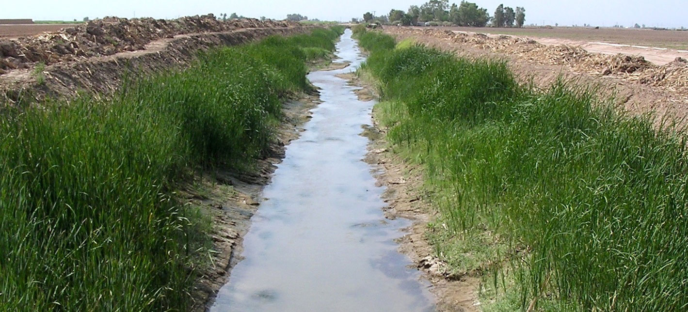
7. Sediment transport and deposition processes are unique in irrigation-dominated watersheds compared to typical precipitation-dominated watersheds.
6. Coherence and phasing of hydrometerological controls on water levels are important to the eco-geomorphology of tidal freshwater wetlands.
5. Urban streams can have natural functionality rehabilitated through a blend of hydrologic management and channel engineering.
4. Instantaneous lift is more important than mean drag in causing riverbed scour in the downstream vicinity of riverbed steps
3. All rivers are eventually hit by big floods that dramatically re-organize fluvial landforms.  I postulated the "reverse domino" mechanism for riffle-pool reorganization to explain how this works in gravel and cobble bedded rivers.
2. Sediment transport through dry-climate watersheds is strongly governed by hydrologic history and land use history. Thus, instantaneous suspended sediment load is poorly predicted by instantaneous discharge.
1. Rivers naturally exhibit multiple layers of topographic variability that can be quantified using geomorphic covariance structures (GCSs). In turn, analytical GCSs that summarize the essential variations found in natural rivers can be used in river design for a variety of applications.
>Scientific Highlights
  • Home
  • About Me
  • Research
    • Scientific Highlights
    • Projects
      • Near-Census River Science
        • 2DMUs
        • Hydraulic Topography
        • Topographic Change Detection
        • Topographic Change Processes
        • Floodplain Inundation
        • Streamwood Storage
        • Upper South Yuba
        • Salmonid Migration
        • North Yuba River
        • Salmon Migratory Habitat
      • Geomorphic Covariance Structures
      • Synthetic River Valleys
      • Watershed Processes
        • Watershed Sediment Transport
        • Watershed Streamwood
        • Watershed Sedimentation
      • River Rehabilitation
        • Spawning Habitat Rehabilitation
        • Cobble/Gravel Injection
        • Streamwood Jams
        • Geomorphologist's Guide
      • Waterfalls
        • Horseshoe Falls
        • NSEAM 1.0
        • Hydraulic Jumps
        • Small Step Mapping
        • Small Step Hydraulics
      • Tidal Freshwater Deltas
        • TFD Introduction
        • TFD Vegetation
        • TFD Sediment Cycles
        • TFD Ecogeomorphology
        • TFD Hydrometeorology
        • TFD Sediment Transport
        • TFD Modeling
        • TFD Animal Response
        • Bush River, MD
        • Winter's Run, MD
      • Estuarine Processes
        • Salinas River Estuary
        • San Joaquin-Sacramento Delta
        • Blackwater National Wildlife Refuge
        • Long Island Sound
      • Functional Flows Model
      • Volcanic Lakes
        • VL Classification & Modeling
        • VL Bibliography
        • Keli Mutu
          • Remote Sampling Strategy
        • Lake Batur
        • Other Volcanic Lakes
      • Agricultural Sediment
      • Urban Rivers
      • Chaos in Hydrology
      • Channel Types
    • Methods
      • Net Sedimentation Tile (NST) Protocol
      • Sediment Core Processing Protocol
      • Vibracoring Protocol
      • Loss-On-Ignition Protocol
      • C-14 Sample Selection and Prep Protocol
      • Cation Sample Prep and Analysis Protocol
      • Grain Size Distirbution Protocol
      • MS Word Fig. code
      • Kite Blimp Method
      • Laser Granulometer Protocol
    • Software
      • River Builder
    • Sponsors
  • Teaching
    • SAS 004Y : Water in Popular Culture
      • Course Logistics
      • Sections
      • Syllabus
        • SAS004 Introduction
        • Water Scarcity
        • Water Scarcity Discussion
        • Floods
        • Flood Insurance Discussion
        • Water Quality
        • Water Quality Discussion
        • Water & Psychology
        • Water Psychology Discussion
        • Conquering Nature
        • Conquering Nature Discussion
        • Pro Poor Water
        • Pro Poor Water Discussion
        • Arctic Socio-Ecology
        • Indigenous Knowledge
        • Earth Stewardship
        • Earth Stewardship Discussion
        • Global Climate Change
        • Global Climate Change Discussion
        • Coastal Zone in Crisis
        • Coastal Zone Crisis Discussion
        • Course Review
      • Readings
      • Instructor
      • Classroom Behavior
      • Grading Policy
      • Movie Logs
      • Discussion Activities
      • Expository Essay
      • Study Guide
      • Online TA Help
    • ESM 125: River Conservation
      • Syllabus
        • River Conservation Introduction
        • Navigability For Title - Law
        • River Segmentation
        • Historical Hydrology
        • Indigenous River Conservation
        • Habitat Conservation Law
        • Aquatic Habitat
        • Riparian Habitat
        • Water Temperature
        • Sediment Sampling
        • Water Quality
        • CA State Water Boards
        • Biological Opinions
        • Setting Biological Goals
        • County-Level Water Management
        • River Restoration
        • Fish Passage & Fishways
        • Beaver-Assisted Restoration
        • Water Management Lessons
      • Instructor
      • Grading Policy
      • Readings
      • Exams
      • Individual Assignments
      • River Presentations
      • Video Response Canvas Quizzes
      • Reading Response Canvas Quizzes
    • HYD 143 : Ecohydrology
      • Instructor
      • Grading Policy
      • Syllabus
        • Chapter 1
        • Chapter 2
        • Chapter 3
        • Chapter 4
        • Chapter 5
        • Group Activity 1
        • Group Presentations 1
        • Chapter 6
        • Chapter 7
        • Chapter 8
        • Chapter 9
        • Group Activity 2
        • Group Presentations 2
        • Chapter 10
        • Chapter 11
        • Chapter 12
        • Chapter 13
        • Chapter 14
        • Chapter 15
        • Group Activity 3
        • Group Presentations 3
        • Chapter 16
        • Chapter 17
        • Chapter 18
        • Chapter 19
        • Chapter 20
        • Chapter 21
      • Online TA Help
      • Video Response Quizzes
      • Group Presentations
      • In-class Assignments
    • HYD 151 : Field Methods in Hydrology
      • Instructor
      • TA Info
      • Grading Policy
      • Syllabus
        • Chapter 21
        • Chapter 1
        • Chapter 2
        • Chapter 3
        • Chapter 4
        • Assignment 1
        • Chapter 5
        • Chapter 6
        • Assignment 2
        • Chapter 7
        • Chapter 8
        • Chapter 9
        • Assignment 3
        • Chapter 10
        • Chapter 12
        • Chapter 11
        • Chapter 13
        • Chapter 14
        • Assignment 4
        • Chapter 15
        • Chapter 16
        • Chapter 16b
        • Chapter 17
        • Field Equipment Showcase
        • Chapter 18
        • Chapter 19
        • Chapter 20
        • Chapter 22
        • Chapter 23
        • Chapter 24
        • Course Review
      • Readings
      • Online TA Help
      • Field Safety
    • HYD 252: Hillslope Geomorphology and Sediment Budgets
      • Instructor
      • Grading Policy
      • Syllabus
        • Week 1
        • Week 2
        • Week 3
        • Week 5
        • Week 6
        • Week 7
        • Week 8
        • Week 9
        • Week 10
        • Week 4
      • Readings
      • Safety
    • HYD 254Y: Ecohydraulics
      • Instructor
      • Grading Policy
      • Syllabus
        • Introduction to Near-Census River Science
        • Introduction to 2D Modeling
        • 2D Modeling Training
        • 2D modeling discussion & synthesis
        • 2D Modeling Terrain Variability
        • 2D Model Validation
        • Fluvial Landform Assessment
        • Ecological Analysis of Structure and Function
        • Hydrogeomorphic Processes
        • Parameterizing Boundary Roughness
        • Frontiers of River Science
      • Readings
      • Online TA Help
      • Lab Tutorials
    • HYD 256: Geomorphology of Estuaries and Deltas
      • Syllabus
        • Week 1
        • Week 2
        • Week 3
        • Week 4
        • Week 5
        • Week 6
        • Week 7
        • Week 8
        • Week 9
        • Week 10
      • Readings
      • Lab
      • Field Safety
      • Online TA Help
      • Grading Policy
    • Virtual River Methods
      • Syllabus
      • Instructor
      • Grading Policy
      • Readings
      • Assignments
      • Game Setup
  • People
    • MS Students
    • PhD Students
    • Postdocs
    • Committee Advisees
    • Technicians
    • Undergrads
    • Visitors
    • Collaborators
    • Furry Friends
  • Info for Applicants
  • Service
    • Past Service
    • Professional Service
  • Outreach
  • Curriculum Vitae

GET IN TOUCH

  • 223 Veihmeyer Hall
    LAWR Dept., UC Davis
    One Shields Avenue
    Davis, CA 95616
  • (530) 302-5658
  • (530) 752-1552
  • gpast@ucdavis.edu
  • Google Scholar
  • Research Gate
  • ORCID: 0000-0002-1977-4175
  • Dr. Gregory B. Pasternack - Watershed Hydrology, Geomorphology, and Ecohydraulics
UC Davis