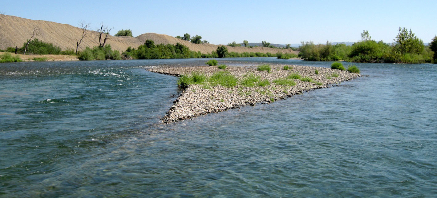
>Bush River, MD
Home » Research » Projects » Tidal Freshwater Deltas » Bush River, MD

Bush River, MD

Chesapeake Bay Context

The Chesapeake Bay system is the largest estuary in North America, having formed via the drowning of the lower Susquehanna River valley during Holocene sea level rise. Because it is subject to multiple fresh water and terrigenous sediment inputs from the rivers on its western shore and an equally influential semidiurnal salt water input from the Atlantic Ocean, Chesapeake Bay is a partially mixed estuary. Along the 200 mile major axis of the Bay there is a decline of salinity from 32 ppt at the junction with the Atlantic Ocean to less than 1 ppt salinity at the mouth of Bush River (Pritchard, 1971). Each tributary mimics this salinity gradient from their brackish junction with the bay up to the fresh stream feeding the head of tidal propagation. As a result the tributaries are considered to be “subestuaries”.

bush.gifBush River, MD

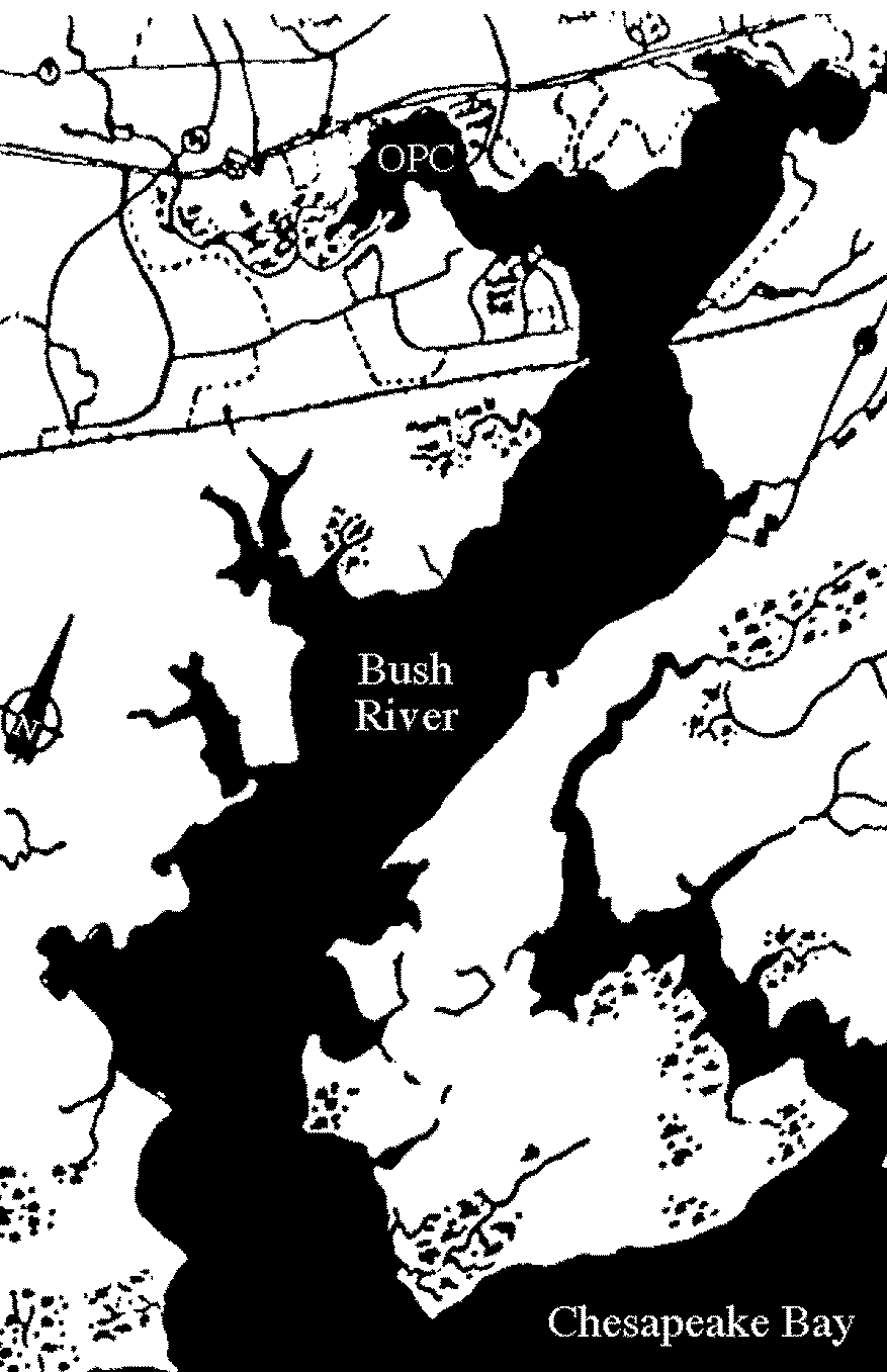
Bush River, into which Otter Point Creek runs, is itself a tributary of ChesapeakeBay. Apparently Bush River has received little scientific scrutiny except to find that 18.1% of its volume is intertidal and the tidal range at its mouth is 0.36 m on average (Cronin, 1971). Presently, Jim bailey, a wetland biologist at Aberdeen Proving Ground, is leading an effort to study submerged aquatic vegetation in Bush River. The Anita C. Leight Estuary Center located at Otter Point Creek is also promoting research of Bush River.


References:

  • Cronin, W.B., 1971, Volumetric, areal, and tidal statistics of the Chesapeake Bay Estuary and its tributaries: Special Report 20, Chesapeake Bay Institute. 
  • Pritchard, D.W., 1971, Chemical and physical oceanography of the Chesapeake Bay: in Schubel, J.R., The estuarine environment, estuaries and estuarine sedimentation: Am. Geol. Inst., Chapter IVA, 28p.
>Bush River, MD
  • Home
  • About Me
  • Research
    • Scientific Highlights
    • Projects
      • Near-Census River Science
        • 2DMUs
        • Hydraulic Topography
        • Topographic Change Detection
        • Topographic Change Processes
        • Floodplain Inundation
        • Streamwood Storage
        • Upper South Yuba
        • Salmonid Migration
        • North Yuba River
        • Salmon Migratory Habitat
      • Geomorphic Covariance Structures
      • Synthetic River Valleys
      • Watershed Processes
        • Watershed Sediment Transport
        • Watershed Streamwood
        • Watershed Sedimentation
      • River Rehabilitation
        • Spawning Habitat Rehabilitation
        • Cobble/Gravel Injection
        • Streamwood Jams
        • Geomorphologist's Guide
      • Waterfalls
        • Horseshoe Falls
        • NSEAM 1.0
        • Hydraulic Jumps
        • Small Step Mapping
        • Small Step Hydraulics
      • Tidal Freshwater Deltas
        • TFD Introduction
        • TFD Vegetation
        • TFD Sediment Cycles
        • TFD Ecogeomorphology
        • TFD Hydrometeorology
        • TFD Sediment Transport
        • TFD Modeling
        • TFD Animal Response
        • Bush River, MD
        • Winter's Run, MD
      • Estuarine Processes
        • Salinas River Estuary
        • San Joaquin-Sacramento Delta
        • Blackwater National Wildlife Refuge
        • Long Island Sound
      • Functional Flows Model
      • Volcanic Lakes
        • VL Classification & Modeling
        • VL Bibliography
        • Keli Mutu
          • Remote Sampling Strategy
        • Lake Batur
        • Other Volcanic Lakes
      • Agricultural Sediment
      • Urban Rivers
      • Chaos in Hydrology
      • Channel Types
    • Methods
      • Net Sedimentation Tile (NST) Protocol
      • Sediment Core Processing Protocol
      • Vibracoring Protocol
      • Loss-On-Ignition Protocol
      • C-14 Sample Selection and Prep Protocol
      • Cation Sample Prep and Analysis Protocol
      • Grain Size Distirbution Protocol
      • MS Word Fig. code
      • Kite Blimp Method
      • Laser Granulometer Protocol
    • Software
      • River Builder
    • Sponsors
  • Teaching
    • SAS 004Y : Water in Popular Culture
      • Course Logistics
      • Sections
      • Syllabus
        • SAS004 Introduction
        • Water Scarcity
        • Water Scarcity Discussion
        • Floods
        • Flood Insurance Discussion
        • Water Quality
        • Water Quality Discussion
        • Water & Psychology
        • Water Psychology Discussion
        • Conquering Nature
        • Conquering Nature Discussion
        • Pro Poor Water
        • Pro Poor Water Discussion
        • Arctic Socio-Ecology
        • Indigenous Knowledge
        • Earth Stewardship
        • Earth Stewardship Discussion
        • Global Climate Change
        • Global Climate Change Discussion
        • Coastal Zone in Crisis
        • Coastal Zone Crisis Discussion
        • Course Review
      • Readings
      • Instructor
      • Classroom Behavior
      • Grading Policy
      • Movie Logs
      • Discussion Activities
      • Expository Essay
      • Study Guide
      • Online TA Help
    • ESM 125: River Conservation
      • Syllabus
        • River Conservation Introduction
        • Navigability For Title - Law
        • River Segmentation
        • Historical Hydrology
        • Indigenous River Conservation
        • Habitat Conservation Law
        • Aquatic Habitat
        • Riparian Habitat
        • Water Temperature
        • Sediment Sampling
        • Water Quality
        • CA State Water Boards
        • Biological Opinions
        • Setting Biological Goals
        • County-Level Water Management
        • River Restoration
        • Fish Passage & Fishways
        • Beaver-Assisted Restoration
        • Water Management Lessons
      • Instructor
      • Grading Policy
      • Readings
      • Exams
      • Individual Assignments
      • River Presentations
      • Video Response Canvas Quizzes
      • Reading Response Canvas Quizzes
    • HYD 143 : Ecohydrology
      • Instructor
      • Grading Policy
      • Syllabus
        • Chapter 1
        • Chapter 2
        • Chapter 3
        • Chapter 4
        • Chapter 5
        • Group Activity 1
        • Group Presentations 1
        • Chapter 6
        • Chapter 7
        • Chapter 8
        • Chapter 9
        • Group Activity 2
        • Group Presentations 2
        • Chapter 10
        • Chapter 11
        • Chapter 12
        • Chapter 13
        • Chapter 14
        • Chapter 15
        • Group Activity 3
        • Group Presentations 3
        • Chapter 16
        • Chapter 17
        • Chapter 18
        • Chapter 19
        • Chapter 20
        • Chapter 21
      • Online TA Help
      • Video Response Quizzes
      • Group Presentations
      • In-class Assignments
    • HYD 151 : Field Methods in Hydrology
      • Instructor
      • TA Info
      • Grading Policy
      • Syllabus
        • Chapter 21
        • Chapter 1
        • Chapter 2
        • Chapter 3
        • Chapter 4
        • Assignment 1
        • Chapter 5
        • Chapter 6
        • Assignment 2
        • Chapter 7
        • Chapter 8
        • Chapter 9
        • Assignment 3
        • Chapter 10
        • Chapter 12
        • Chapter 11
        • Chapter 13
        • Chapter 14
        • Assignment 4
        • Chapter 15
        • Chapter 16
        • Chapter 16b
        • Chapter 17
        • Field Equipment Showcase
        • Chapter 18
        • Chapter 19
        • Chapter 20
        • Chapter 22
        • Chapter 23
        • Chapter 24
        • Course Review
      • Readings
      • Online TA Help
      • Field Safety
    • HYD 252: Hillslope Geomorphology and Sediment Budgets
      • Instructor
      • Grading Policy
      • Syllabus
        • Week 1
        • Week 2
        • Week 3
        • Week 5
        • Week 6
        • Week 7
        • Week 8
        • Week 9
        • Week 10
        • Week 4
      • Readings
      • Safety
    • HYD 254Y: Ecohydraulics
      • Instructor
      • Grading Policy
      • Syllabus
        • Introduction to Near-Census River Science
        • Introduction to 2D Modeling
        • 2D Modeling Training
        • 2D modeling discussion & synthesis
        • 2D Modeling Terrain Variability
        • 2D Model Validation
        • Fluvial Landform Assessment
        • Ecological Analysis of Structure and Function
        • Hydrogeomorphic Processes
        • Parameterizing Boundary Roughness
        • Frontiers of River Science
      • Readings
      • Online TA Help
      • Lab Tutorials
    • HYD 256: Geomorphology of Estuaries and Deltas
      • Syllabus
        • Week 1
        • Week 2
        • Week 3
        • Week 4
        • Week 5
        • Week 6
        • Week 7
        • Week 8
        • Week 9
        • Week 10
      • Readings
      • Lab
      • Field Safety
      • Online TA Help
      • Grading Policy
    • Virtual River Methods
      • Syllabus
      • Instructor
      • Grading Policy
      • Readings
      • Assignments
      • Game Setup
  • People
    • MS Students
    • PhD Students
    • Postdocs
    • Committee Advisees
    • Technicians
    • Undergrads
    • Visitors
    • Collaborators
    • Furry Friends
  • Info for Applicants
  • Service
    • Past Service
    • Professional Service
  • Outreach
  • Curriculum Vitae

GET IN TOUCH

  • 223 Veihmeyer Hall
    LAWR Dept., UC Davis
    One Shields Avenue
    Davis, CA 95616
  • (530) 302-5658
  • (530) 752-1552
  • gpast@ucdavis.edu
  • Google Scholar
  • Research Gate
  • ORCID: 0000-0002-1977-4175
  • Dr. Gregory B. Pasternack - Watershed Hydrology, Geomorphology, and Ecohydraulics
UC Davis