
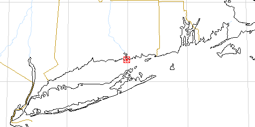
Long Island Sound
Participants
This research was conducted in the Earth & Environmental Sciences Department at Wesleyan University under Prof. Joop Varekamp, my undergraduate mentor. It was a small, early component of a very large, on-going effort to comprehensively describe the geochemistry of Long Island Sound.
Purpose
The purpose of this study was to determine the amount of inorganic pollution in sediment samples collected from salt marshes along the Long Island Sound. Pollution was assessed by characterizing chemical composition and exploring origins and modes of transport. Zinc, copper, and lead were found to be possible pollutants in the studied sediments, but no conclusion could be made about iron, potassium, magnesium and sulfur because of the lack of historical data. As expected, the predominant constituent compounds are silicon dioxide and aluminum oxide. The distribution of all elements and compounds examined strongly supports the conclusion that the greatest deposition of contaminants is occurring in the salt marsh (site F1) while greatest concentrations of water contaminants are in the mudflat/beach waters (site B1).
Methods & Results
First, the quantities of pollutant elements in a leachable form were measured and compared with pre-industrialization quantities. All samples were taken from the sediment surface in a region with a sedimentation rate of approximately 2.7 mm/year (Varekamp, unpublished data) so the metals found were either representative of a present influx or in situ changes/diagenesis. Based on previous case studies (Varekamp,unpublished) the following quantities of metals were expected to be found as an average baseline: 25ppm Zn, 10ppm Cu, 5ppm Pb, and 1.5% by weight Fe. Compared to this baseline there was evidence of some zinc pollution. A stronger signal is visible for copper. Used in wires because of its high electrical conductivity and low cost relative to silver (the only element with a greater electrical conductivity) as well as a significant byproduct from coal burning, copper is widely distributed throughout the environment. Thus, there is little surprise in the quantities found which are all 3-4 times the pre-industrial level in the sediment. Unfortunately, both copper and zinc levels may increase with addition of lead to the reservoir since both are bound constituents of iron minerals.
It is certainly possible that the noted increases explained as deriving from anthropogenic emissions may to some extent be due to the introductionof more iron minerals from lithogenic and diagenetic inputs. To assess this possibility one may compare the Zn/Fe past and present concentration ratios as well as those for Cu/Fe. If the ratios are greater in the present than the past, then the recent zinc and copper influxes are independent of iron and are likely results of human activity. Turning to iron, our study shows a dramatic deficiency in B1 samples relative to the baseline. Because the water in the beach area is relatively physically active it is unlikely that much iron would settle out there. The baseline, established at a mudflat behind Griswold point, is more sheltered and therefore more amenable to the settling out of materials. No analysis along these lines can be made for the CY1 and F1 samples because the baseline used for comparison (the only one available) cannot accurately be applied to marsh or estuarine settings. Whereas iron is used in steel production and is a byproduct of combustion, it is expected to be present in large quantities. However, it is also found in many primary and secondary minerals in a significant weight percent, so it is not possible to say that increases are necessarily anthropogenic in nature.
Even greater than the signal from copper is that from lead, a pollutant known to cause sterility and attack the human nervous system. Derived from sources as far flung as automobile gasoline (before 1974) and piping, lead quantities in CY1 were a whopping 15 times that of the baseline proving conclusively that the amount has increased. Rounding off the analysis are magnesium, potassium, and sulfur which cannot be identified as pollutants because there is no current basis for comparison. One observation that can be made about sulfur, though, is the extent to which it was lost upon ignition in the test for organic carbon content. From basic geochemistry it is known that the burning of a sediment sample derived from a reducing environment will result in the oxidation of iron and sulfur by free atmospheric oxygen. The sulfur dioxide produced is lost because it is a gas. Given the sulfur content from an Ion Chromatograph (IC) analysis and the iron content from an Atomic Adsorption Spectrophotometry (AAS) analysis, it is possible to calculate the amount lost and then correct the organic content weight percent by that amount:
A) Determination of Sulfur present assuming it is all present as pyrite.
- 0.0226g Sulfur = 7.05 x 10^-4 moles Sulfur
- 0.0180g Iron = 3.20 x 10^-4 moles Iron
- Fe(2+) + 2SO4 + 2H(+) --> FeS2 + 3.5O2 + H2O (Pyrite formation)
- Stoichiometry from #3 indicates a 1:2 ratio of Fe:S
- Actual ratio= 1:2.203 so iron is the limiting reactant.
- Actual amount of Sulfur used = 6.4 x 10^-4 moles = .0205g
B) Given total grams lost on ignition, divide that into .0205g S and multiply the result by 100 to determine the percent of LOI caused by sulfur.
Second, it has been possible to characterize the chemical make-up ofsediment samples using X-ray fluorescence (XRF). The primary components in all samples were silicon dioxide (50-65% by weight), aluminum oxide (13-16%), sodium oxide (3-6%), and iron (III) oxide (6%). Trace constituents found were magnesium oxide, titanium oxide, calcium oxide, and potassium oxide. Variations between samples will be discussed in the next section. For those elements also studies with AAS, XRF provides a means for assessing the degree of mobility of the cations in the silicate framework as opposed to those occupying active sites. For our study the sediments were left in a leachate solution of hydrochloric and nitric acids for eight hours. Even with this heavy leaching, only the following quantities were removed from the mineral (using average values from AAS):
| F1 | CY1 | B1 | |
| Mg | 31% | 28.3% | 25.7% |
| Fe | 30.5% | 22.2% | 5.2% |
| K | 1.0% | 0.66% | 0.16% |
While the percentages of Mg and Fe are reasonable given that these elements are strongly bound, the low percentage of potassium released is surprising. Typically potassium occupies active exchange sights and is easily removed with leaching. Comparison across samples indicates a consistent trend in which the most metal was leached from F1 and the least from B1. Since marsh sediment (F1) consists of flocculated muds and clays as well as some precipitates, metal compounds and ions are relatively easily dissolved and leached into solution. The B1 sample, on the other hand, has the highest silicon dioxide content and lithogenic grains like quartz have low solubility products, even in strong acids. Finally, comparison between the different regimes reveals a trend in metal concentrations and suggests possible mechanisms for pollutant transport. Before any comparative analysis can be done, all values should be normalized over some stable parameter. Since all studied sediment was of the <63um fraction, all aluminum contained within should be locked in the mineral structure and hence stable throughout the leachate process. Normalization over this parameter results in the following metal ion concentrations (using average AAS values for each regime):
| Pb | Cu | Zn | K | Mg | Fe | |
| F1 | 3.18 | 1.95 | 1.95 | 16.0 | 526.7 | 1132.1 |
| CY1 | 4.1 | 2.54 | 2.03 | 13.4 | 435 | 979 |
| B1 | --- | --- | 1.62 | 3.05 | 339.7 | 220.5 |
From this analysis it is clear that magnesium, iron, and potassium concentrations are all highest in the F1 samples followed by CY1 and then B1. Likewise, a similar trend exists for aluminum oxide, sodium oxide, magnesium oxide, and titanium oxide according to the XRF. Silicon dioxide, on the other hand, was found by XRF to exhibit the reverse trend. In terms of water analysis, the samples were only tested for potassium and magnesium, and in both cases the trend was the reverse of that found in the leachates. Because the marsh environment (F1) is only periodicallyinundated and the water that flows in is left in "storage" for a long time, it makes sense that the metals in that water would have ample opportunity to undergo chemical and biological activity resulting in its precipitation or settling out. Furthermore, atmospheric inputs to this "box" would enter storage presently and not be diluted. Hence, highly concentrated sediments and weakly concentrated waters will be the result, just as this study found. Following the same line of logic, water in the beach regime is always being mixed in three dimensions and moved along by winds, currents, and (perhaps) thermohaline gradients. As a result, metal solutes are diluted and have less opportunity to enter the sediment pile. Atmospheric input to the bottom sediments in this regime is limited. Therefore it is expected, just as it was found, that leachate concentrations would be the lowest of the three regimes while water concentrations would be the highest of the three. Finally, since the CY1 region is like the beach/mudflat area in that it is flooded twice a day but is like the marsh area in that it is calm the rest of the time, it has metal concentration values intermediate between the two for both its sediment and water. The fact that in potassium, magnesium, and iron leachate normalized concentrations, and in magnesium water concentrations, the CY1 estuarine regime is closer in quantity to F1 than B1 indicates two possibilities: 1) that it more closely resembles the former than the later or 2) the small river that it includes contributes contaminants to the"box".
References
- Varekamp, Johan C. 1990. "Trace Element Geochemistry and Pollution Historyof Mudflat and Marsh Sediments from the Connecticut Coastline."
