Topographic Change Detection
Participants
Gregory B. Pasternack, Jennifer Carley, Joshua R. Wyrick, Rocko Brown, Matthew Weber, Arielle Gervasi
Background
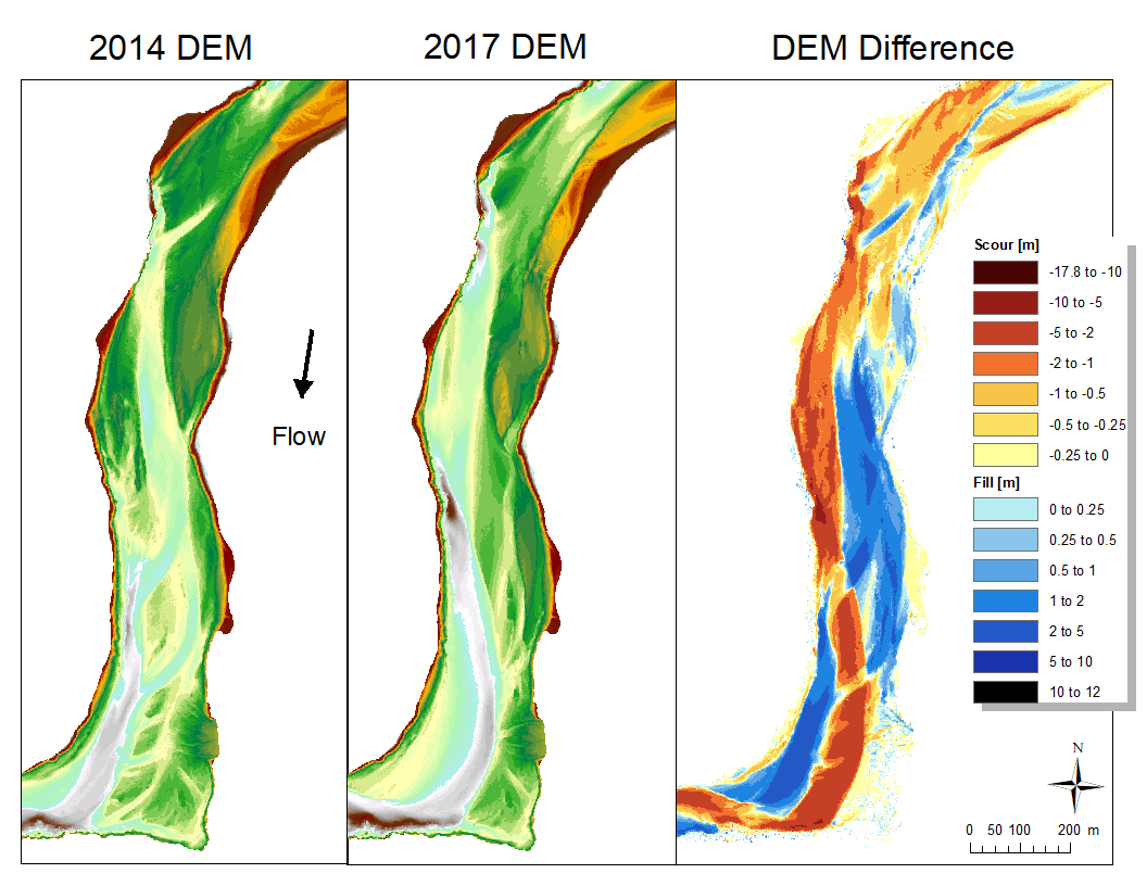
Topographic change is the rise or fall of the elevation of the Earth's surface through time. Conceptually, tracking topographic change ought to be as simple as mapping the landscape at two times and then observing how it changed. Unfortunately, it is not that simple, because there are many sources of error, such as measurement technology errors and the errors associated with the fact that the points in the two maps are not at exactly the same locations in both surveys. This project has developed new approaches for detecting topographic change from uncertain datasets to create a statistically significant Level of Detection (LoD) raster. This LoD raster is then subtracted from the raw difference in the DEMs; we are left with the statistically significant changes, in terms of either fill or scour, to understand the natural phenomenon of topographic change within the river over a specified time interval.
Sample DEM difference map
Publications
- Carley, J. K., Pasternack, G. B., Wyrick, J. R., Barker, J. R., Bratovich, P. M., Massa, D. A., Reedy, G. D., Johnson, T. R. 2012. Significant decadal channel change 58-67 years post-dam accounting for uncertainty in topographic change detection between contour maps and point cloud models. Geomorphology 179: 71-88, doi:10.1016/j.geomorph.2012.08.001.
- Brown, R. A. and Pasternack, G. B. 2014. Assessment of the 2012 gravel/cobble augmentation in the Englebright Dam reach of the lower Yuba River, CA in response to atmospheric river floods. Prepared for the U.S. Army Corps of Engineers, Sacramento District. University of California at Davis, Davis, CA, 37pp.
- Pasternack, G. B., Wyrick, J. R. 2016. Flood-driven topographic changes in a gravel-cobble river over segment, reach, and unit scales. Earth Surface Processes and Landforms. doi: 10.1002/esp.4064.
- Weber, M.D., Pasternack, G., 2017. Valley-scale morphology drives differences in fluvial sediment budgets and incision rates during contrasting flow regimes. Geomorphology 288, 39-51.


