
SFBA Stream Types
Project Team Leaders
Dr. Zhihao Wang, Prof. Greg Pasternack, Prof. Yufang Jin.
Project Organizations
University of California at Davis, San Jose State University, Contra Costa Resource Conservation District, Napa Resource Conservation District, North Santa Clara Resource Conservation District, SafeR3, University of California Agriculture and Natural Resources
Project Sponsors
This research was supported by funds from the Climate Action 2023 Seed Awards of the University of California, Grant Number R02CP6967. This project was also supported by the USDA National Institute of Food and Agriculture, Hatch project numbers CA-D-LAW-7034-H and CA-DLAW-2620-H.
Scientific Publications
We have several scientific journal articles in various stages of production and peer review. As they are published, this section will be updated with citations and links to the articles.
- Wang, Z., Pasternack, G. B., Jin, Y., Kumar, N., Rampini, C., Alexander, S., Storesund, R., Perales, M., Lim, C., Moreno, S., Lacan, I. 2025. Artificial-Intelligence-guided Geomorphic Field Site Sampling Design for River Classification. International Journal of Applied Earth Observation and Geoinformation 14: 104742. DOI: 10.1016/j.jag.2025.104742.
- Wang, Z., Pasternack, G. B., Jin, Y., Rampini, C., Alexander, S., Kumar, N., Perales, M., Lim, C., Moreno, S., Storesund, R., Lacan, I. in press. Bridging Natural and Artificial: Stream Reach Classification for Mixed Watersheds. GSA-Bulletin.
I'm In A Rush- Skip Down to Stream Types!
Click here to skip down to the list of SFBA stream types!
Introduction
We have produced a video explaining what stream classification is at the link below:
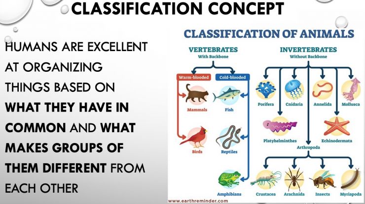
A classification organizes and prioritizes information so that like entities can be matched up and addressed efficiently with a common framework, while unlike entities can be appropriately treated differently. Classifications are often used globally for regional environmental management (Lane et al., 2017). They are also the basis for California’s regional environmental flows framework (Lane et al., 2022).
While stream classification has been pursued by geoscientists and ecologists for more than 70 years and is well justified, there has been a strong bias against considering where artificial streams fit into such classifications. There are a few classifications that consider some types of artificial channels in individual, narrow enigneering contexts (e.g. mining channels, agricultural canals) and several "evolutionary" frameworks that position some types of human-degraded streams into a system. However, there are no geophysical stream classifications that span the diversity of both natural and artificial stream types, let alone one made on an evidence-basis justified by data.
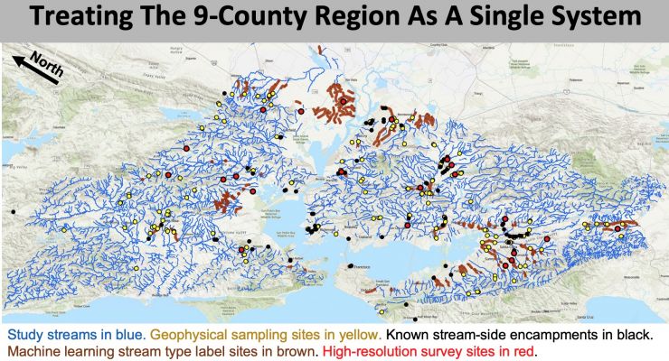
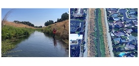
In this project, we developed a stream classification spanning natural and artificial stream types for the 9-county San Francisco Bay Area. Once the stream types were determined, then we created a set of archetypes (sensu Cullum et al., 2016) to study the details of each stream type. These archetypes can then be used in adaptive management to identify pathways to achieve climate resilience. Through transdisciplinary engagement with archetypes, policy and management recommendations for USC types can be arrived at by consensus, including design guidance for NbS that benefit the most climate-vulnerable urban dwellers. Our activities will help urban & climate planners, social service providers, & homeless-advocacy groups reduce negative impacts of unhoused living on the people experiencing it, while conversely helping reduce negative impacts of unhoused living on USCs & adjacent communities.
Study Area
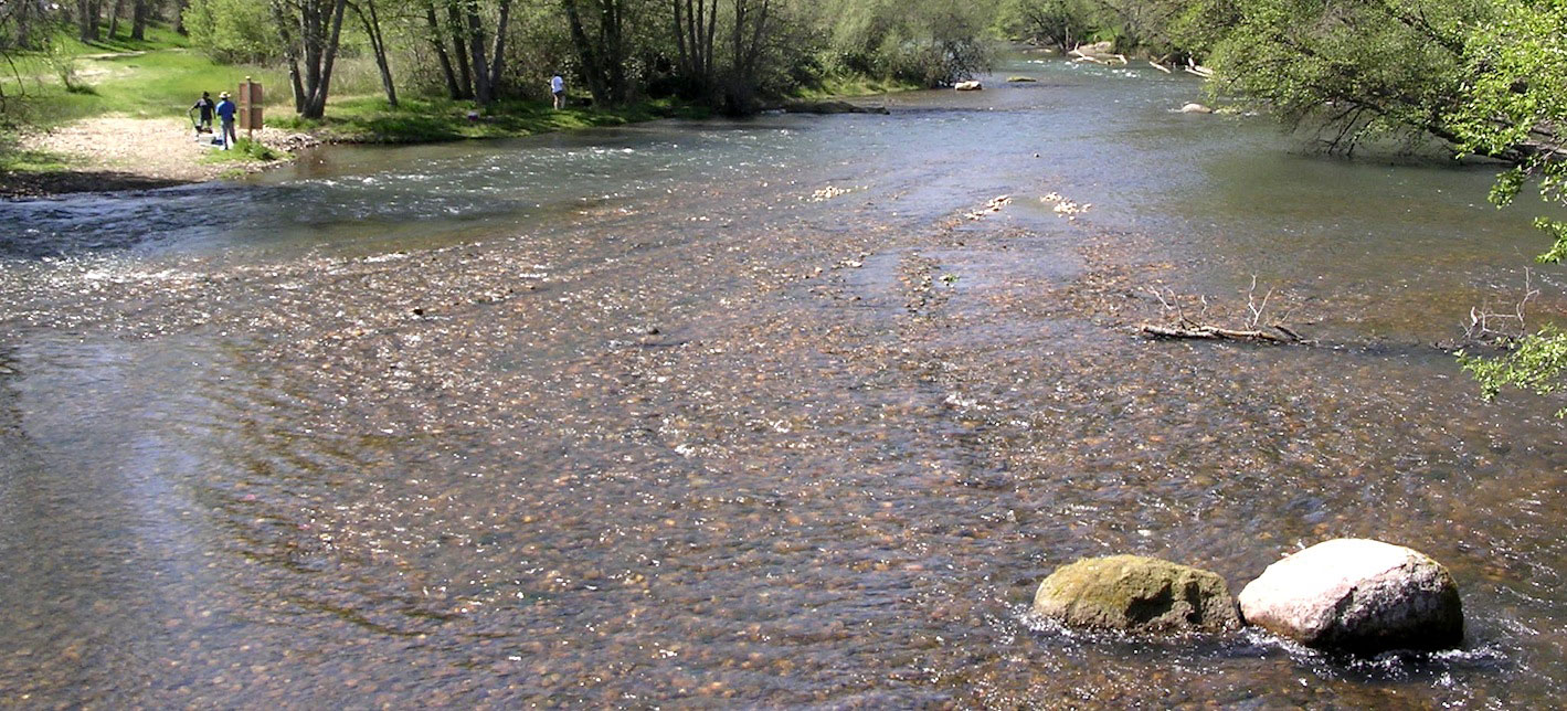
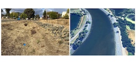
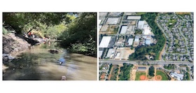
The study area for this project was the 9-county San Francisco Bay Area.
Experimental Design
The methods in this section have now been publised in the (Wang et al., in press) scientific journal article cited above.
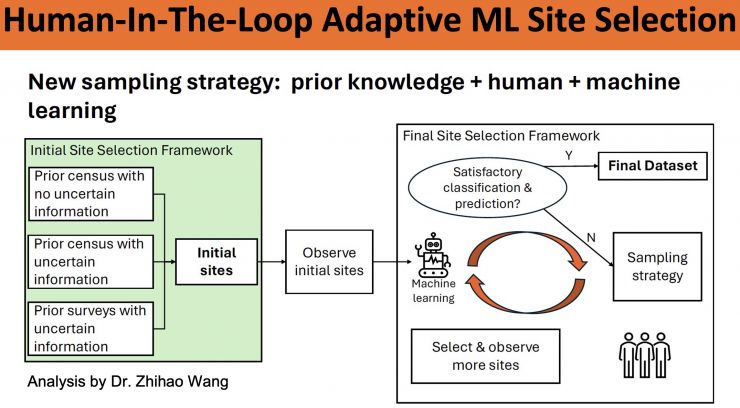
Sufficient abundance and variety of field site sampling are crucial for obtaining an accurate reach-scale river classification of a regional stream network in support of scientific research and river management. However, many studies still randomly select field sites or only visit accessible streams. Machine learning has been recognized for discovering and extracting streams' geomorphic patterns efficiently and accurately from data, but its application in field site sampling design is still in its infancy. This study developed a general and practical field site selection framework by incorporating machine learning in a human-in-the-loop manner. This framework includes three steps: (1) initial field site selection via machine learning from prior datasets, (2) selected field site accessibility evaluation and observation, and (3) additional field site decision and selection via an iterative learning process. In an example application to the San Francisco Bay Area (California, USA), our framework extracted representative geomorphic characteristics of both previous stream types from prior labeled and geospatial datasets and previously unrecognized stream types based on uncertainty information obtained by machine learning. Moreover, we proposed methods for replacing inaccessible sites to ensure sufficient information is retained in the selected field sites. The feasibility of the framework was assessed by statistical analyses of results and empirical validation via field surveys.
Details about the experimental sampling strategy are provided in the video at the link below:
Field Data Collection With Novel Protocol
In this study we developed and implemented a novel fluvial geomorphology, cross-section based topographic surveying methodology. Admittedly, nothing is truly free of bias, but the goal of the protocol is to at least eliminate what has turned into a powerful bias in fluvial geomorphic field surveying- the reliance on bankfull determination.
The new protocol has 5 steps: general site assessment, locating transects, surveying transects, photo documentation, and ancilliary data collection. In our study, the ancilliary data collected was a suite of riverbed sediment grain size distribution metrics.
Details about the new site-assessment protocol are provided in the video at the link below:
Site Variables Produced From Field Data
With the data collected using the PURE Protocol, we were able to compute values for up to 93 variables for each site. Variables are organized into five categories: channel morphometry variables, grain-size variables, valley-floor variables, engineering variables documenting human modifications using shape and composition observations, and single- or multi-threaded channel.
Stream Classification R Markdown Program
To develop the stream classification from the variables computed using field data, we philosophically used a "bottom-up" approach. This means that instead of dictating what types would exist a priori, we let the data speak for itself and produce an evidence-based, objectively defensible set of groups. Of course, any typology can be assailed on a variety of rational bases, but our approach conforms to modern geophysical scientific norms. In fact, we used an existing framework and set of tools already peer reviewed and published in the scientific literature in two journal articles. In this framework, we use an R markdown program we made for statewide, natural river typing. We have updated and modified it as needed for this project. This program performs thorough multivariate statistical analyses, including adherence to statistical and physical assumptions and constraints, yielding a regional stream typology, an uncertainty assessment of classification performance, and identification of which variables are driving what aspects of USC typology (Byrne et al., 2020). Essential multivariate methods include non-metric multidimensional scaling, hierarchical clustering using Ward’s algorithm, and classification and regression tree (CART) analysis.
Introducing the SF Bay Area Stream Types
We have produced a video going through the 12 stream types that you can watch at the link below:
The following columns show the 12 stream types. you can click on them to see detailed information about each type. if nothing happens when you click an image or hyperlink, it is because we have not yet populated that part of the website yet.
REMEMBER: A name is an attempt at a dramatic simplification of a lot of information, so it's never going to be a perfect fit! Try to avoid being too literal or pedantic. A stream that falls into a type may not resemble the name closely, because English and scientific vocabulary lack terms for what this classification captures. Not all A3 streams are naturalizing canals. Not all N2 streams are in the lowlands or in a meadow.
Artificial Stream Types
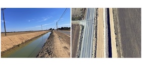
A1 – Armored Channel
Artificial bank and bed in terms of both shape and composition
A2 – Bank-Hardened River
Steep, artificial bank composition, mixed-size natural bed composition including coarse sediment
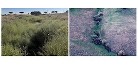
A3 – Naturalizing Canal
Deeply entrenched, wide, natural bank composition, strong bed undulations, coarse bed sediment
A4 – Large Canal
Deeply entrenched, wide, natural bank composition, plane bed, fine sediment, may have emergent wetland plants
A5 – Bank-Hardened Canal
Gentle slope, artificial bank shape & composition, artificial plane bed shape with a majority fine bed sediment
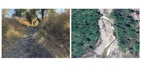
A6 – Ditch
Low to moderate entrenchment, gently sloped, natural bank and bed composition, plane bed, fine bed sediment
Natural Stream Types
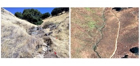
N1 – Headwater Steep Stream
Highly confined, steep, gravel-to-boulder sediment, and strong undulations
N2 – Lowland/Meadow Small Stream
Unconfined valley (may have low rolling hills), low order, low slope, fine sediment, strong bed undulations; may have poorly-defined banks
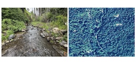
N3 – Mountain Stream
Confined, moderate slope, gravel/cobble bed, strong undulations; step-pool, riffle-pool, plane-bed subtypes; streamwood can dominate
N4 – Entrenched Riffle-Pool Stream
Partially confined, modest slope, deeply entrenched, gravel/cobble sediment, bed undulations
N5 – Valley Floor Riffle-Pool Stream
Any confinement, moderate to low entrenchment, gravel sediment, and bed and width undulations; streamwood optional
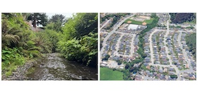
N6 – Large Entrenched Lowland Stream
Large unconfined valley, deeply entrenched, low to modest slope, wide and deep, strong bed undulations, gravel and fine sediment mix
Video Explaining SF Bay Stream Types Using A Dichotomous Key
Fortuitously, the objective CART analysis yielded an approach to determinig which stream type is present at any site that can be achieved entirely by visual inspection. No quantitative measurements are needed.
That said, one does need some basic training in the concepts that underpin the classification to be able to correctly identify the different situations present.
An explanation of 12 SF Bay Area stream types through the lens of the dichotomous key is provided in a slidedeck and video presentation at the links below.
Lessons for SF Bay Area Stream Typing
This series of videos will train you on the things to look for when you are at a stream in the SF Bay Area, so you can correctly identify the stream type. There are 5 videos that you should watch in order.
1. Lessons Introduction & Overview
Link to video: Introduction and overview video
This video introduces you to the 5 key indicators of stream type and covers some overview information that you should be aware of.
2. Is a River's Shape Artificial or Natural?
Link to video: Artificial or natural shape video
This video explains how you can determine if the shape of a river's bed and/or banks is artificial or natural
What is an "artificial" or a "natural" stream? We have also produced a draft report explaining these concepts and illustrating them with several examples.
3. Is a River's Composition Artificial or Natural?
Link to video: Artificial or natural composition video
This video explains how you can determine if the material that makes up the bed and/or banks of a river is artificial or natural.
4. Is a River "Entrenched" and/or "Confined"? If So, To What Degree?
Link to video: Entrenched or confined video
This video defines and explains the concepts of entrenchment and confinement, both of which need to be assessed to determine stream type.
5. What is the Character of the Natural Riverbed Sediment?
Link to video: Riverbed sediment video
This video describes the typical bed sediment types for SF Bay Area streams and how to determine them. it also has some discussion about a few landforms to look for that help identify stream types.
6. Summary of the SFBA Stream Typing Lessons
Link to video: TBD
This video reviews and summarizes the 12 SBFA strem types and introduces a bit about the Survey123 phone app you can use to do stream typing in the Bay Area.
Dichotomous Key Stream Typing App
The preceding sections and videos explain how anyone can determine the stream type of any 200-m stream interval in the SF Bay Area. We have now produced a survey tool on a smartphone app that is free and open for the public to use to do this. We only ask that if you are going to submit your results, then please make sure you watch and understand all the videos explaining the SFBA stream classification and the lessons for doing stream typing in the region.
Note: the classification applies to 200-m stream intervals, but typically people cannot observe a whole 200-m site safely on a reconnaissance basis. Safety and respecting private property are important. Therefore, care is needed when applying the classification to a site on the basis of a limited view of a site.
With practice, both professional and citizen scientists can accurately use the classification.
ArcGIS Survey123 App
Anyone may use the S.F. Bay Area Stream Typing survey via the free app, Survey123.
While it is not required to create an account to use the app, it helps if you do, so that we can know something about who is using the app to help evaluate data accuracy. We do accept anonymous submissions.
- Link to Survey123 App survey: Contact Professor Pasternack for the link
